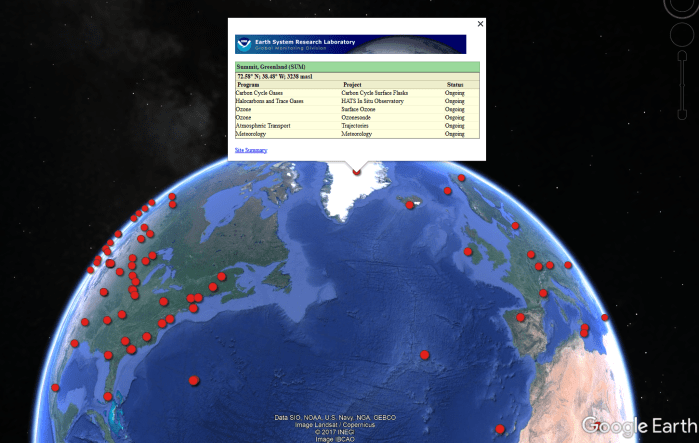
The Carbon Cycle Greenhouse Gases (CCGG) group of NOAA’s Global Monitoring Division have locations all around the world from where their greenhouse gas air samples come from. A full list on an interactive map is here; select “Carbon Cycle Gases” from the drop-down box.
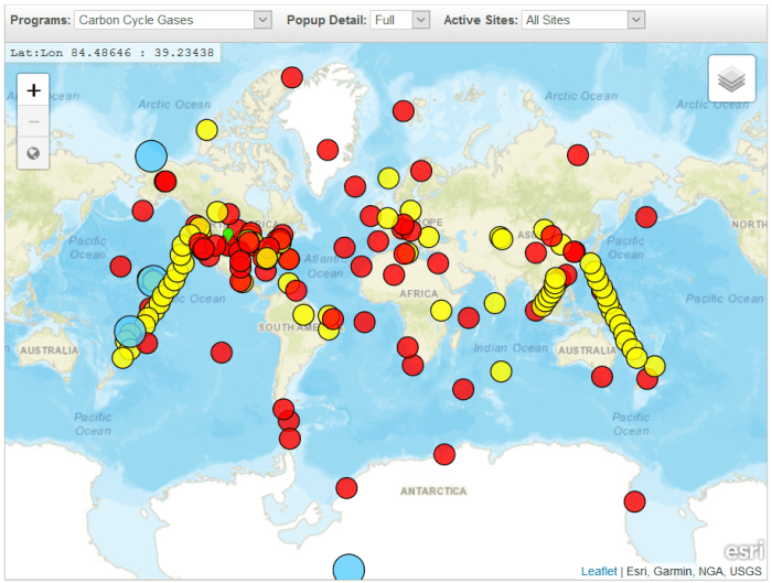
You can also download a Google Earth KML of the sites, allowing you to explore the different locations and landscapes that the sample network cover.
Here are a pick of some of my favourites. The three-letter code is NOAA’s identifier for the sampling site. Each of these sites air samples are analysed for carbon dioxide (CO₂), carbon monoxide (CO), methane (CH₄), hydrogen (H₂), nitrous oxide (N₂0) and sulfur hexaflouride (SF₆).
ALT – Alert, Nunavut, Canada


Fun geographical facts: The most northerly settlement in the world. The average annual temperature is -18°C. April to September sees 24 hours of sunlight.
ASK – Assekrem, Algeria


Fun geographical facts: Exceptionally remote area in the Sahara Desert, with the nearest settlement 50km away. Apparently the local monks are involved in helping collect and send air samples!
BHD – Baring Head Station, New Zealand


Fun geographical facts: The Baring Head Lighthouse was used as a signal station by the armed forces during the Second World War. The operators were exempt from conscription as the lighthouse was important to the war effort.
CHR – Christmas Island (Kiritimati), Kiribati


Fun geographical facts: The UK conducted its first successful nuclear test here in 1957. An extreme drought killed off tens of thousands of coconut palms causing the island to be temporarily abandoned between 1905 and 1912.
HBA – Halley Station, Antarctica (UK)


Fun geographical facts: The Halley VI is the world’s first re-locatable research facility. The ‘hole’ in the ozone layer was first discovered at Halley.
MHD – Mace Head, County Galway, Ireland


Fun geographical facts: The headland protrudes out into the Atlantic, given the prevailing wind from the ocean the area is considered in a ‘clean air sector’ away from human emission sources.
STR – Sutro Tower, San Francisco, California, US


Fun geographical facts: Sutro Tower is used by 11 television stations, four FM radio stations, satellite and cable providers, and nearly two dozen public and commercial wireless communication services.
UUM – Ulaan Uul, Mongolia


Fun geographical facts: According to the Mongolian National Statistical Office Livestock Count, in 2004 there were about 72,000 heads of livestock, among them 23,000 goats, 24,000 sheep, 17,000 cattle, yaks, and khainags, 7,000 horses, and 216 camels.
ZEP – Ny-Alesund, Svalbard, Norway/Sweden


Fun geographical facts: All people in the settlement must carry rifles because of polar bears, and all doors in town remain unlocked for the sake of people seeking cover in the event of an attack. The climate is mild for its northern latitude, due to the North Atlantic Current.
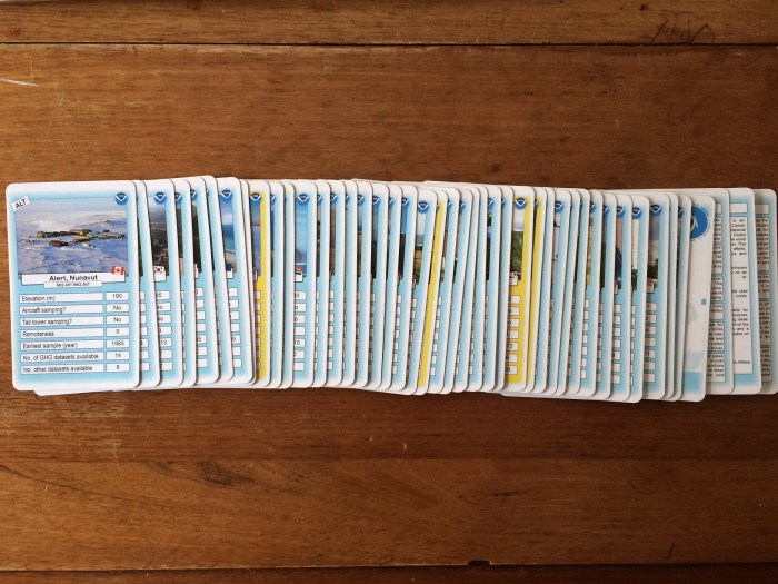
UPDATE (1st Dec 2017): I have created a ‘top trumps’ based card game based on NOAA’s greenhouse gas sampling network. You can download the resource for free from the TES website!

UPDATE (4th Jan 2018): I had a third-party make these into actual playing cards, and they look great! Actually came out better than I expected. 🙂